Utilising raw field data, architectural designs, geo- and ortho-rectified satellite images, PSS is able to generate a wide range of 3-dimensional products. Products include 3-dimensional fly-throughs, walk-throughs, drive arounds and fly-overs. PSS has the capability to generate virtual structures, villages, cities, civil engineering structures and landscapes. Once a 3D model and surrounding terrain have been created, the potential effects on the landscape can be assessed by producing a ZVI – Zone of Visual Impact aided by line of sight sections.
Project impact assessments utilising zones of visual impact (ZVI) software and geospatial data enables the real potential impact of proposed developments in the landscape to be presented and analysed. PSS’s ability to present accurate representation of proposals allows potential problem areas to be identified at the early planning stage.
Design & Modelling
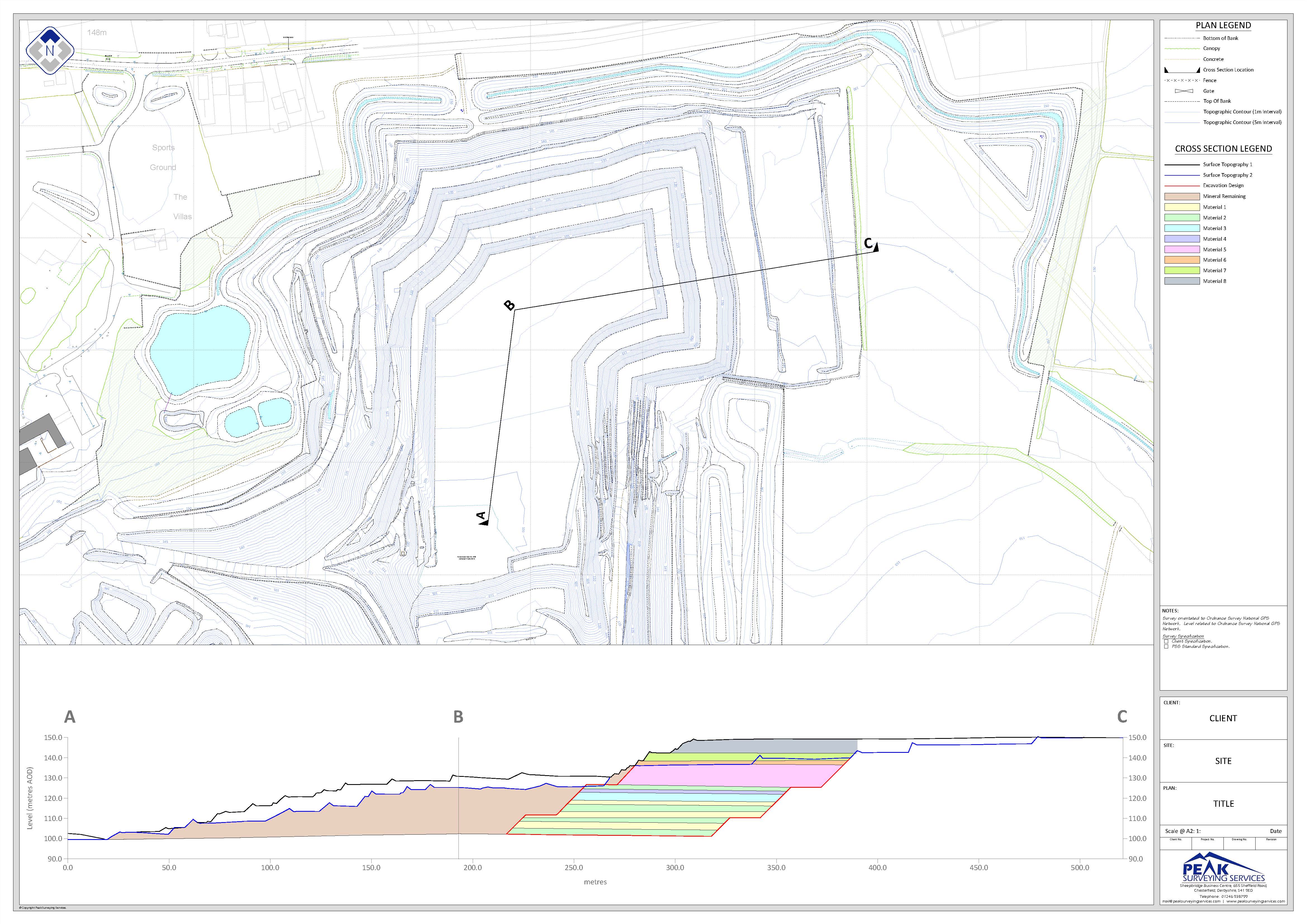
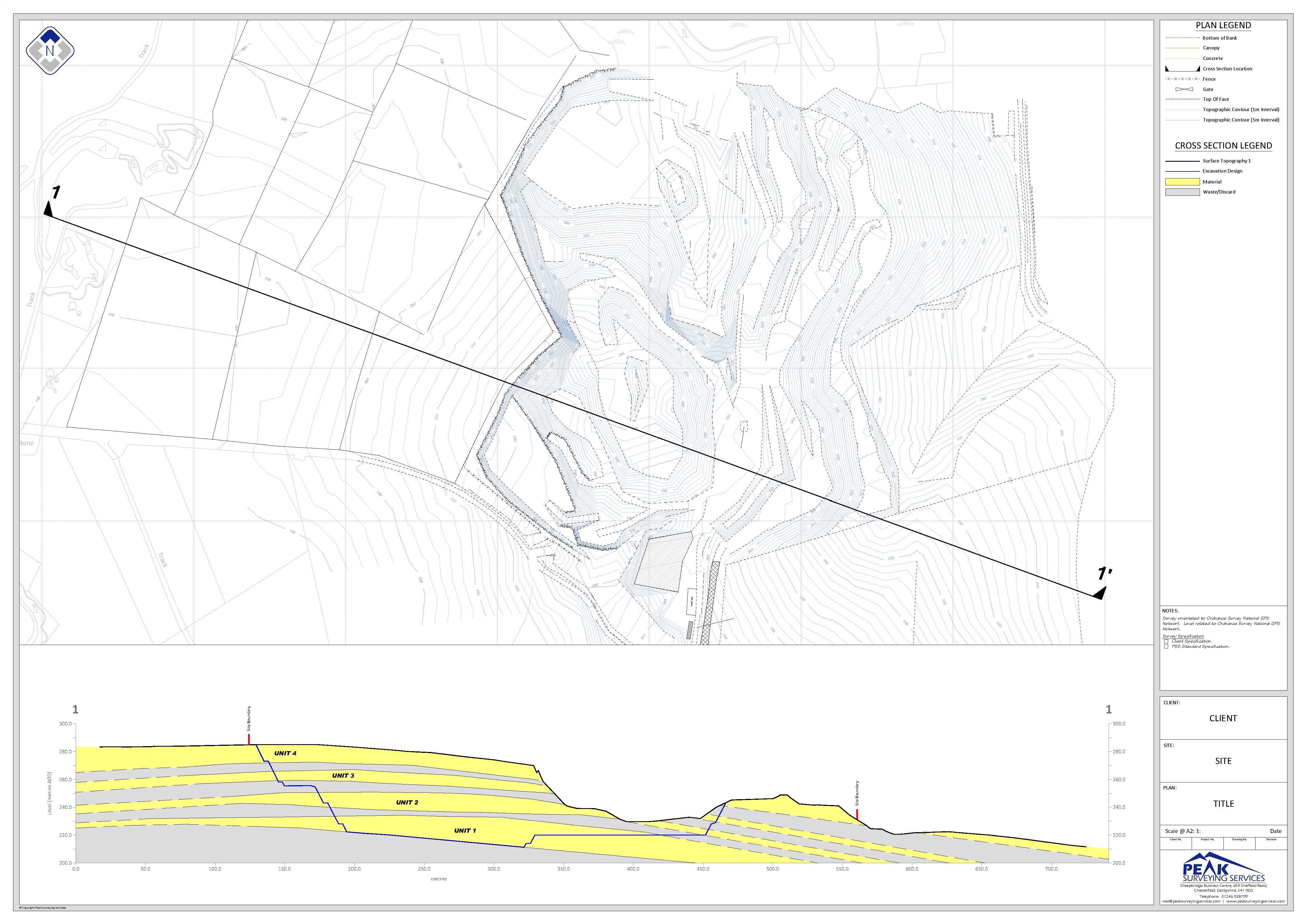
Peak Surveying Services can produce topographic survey plans, operational phase drawings, geological cross-sections and full geotechnical apparaisals and assessments, tip design, slope modelling, screening design etc.
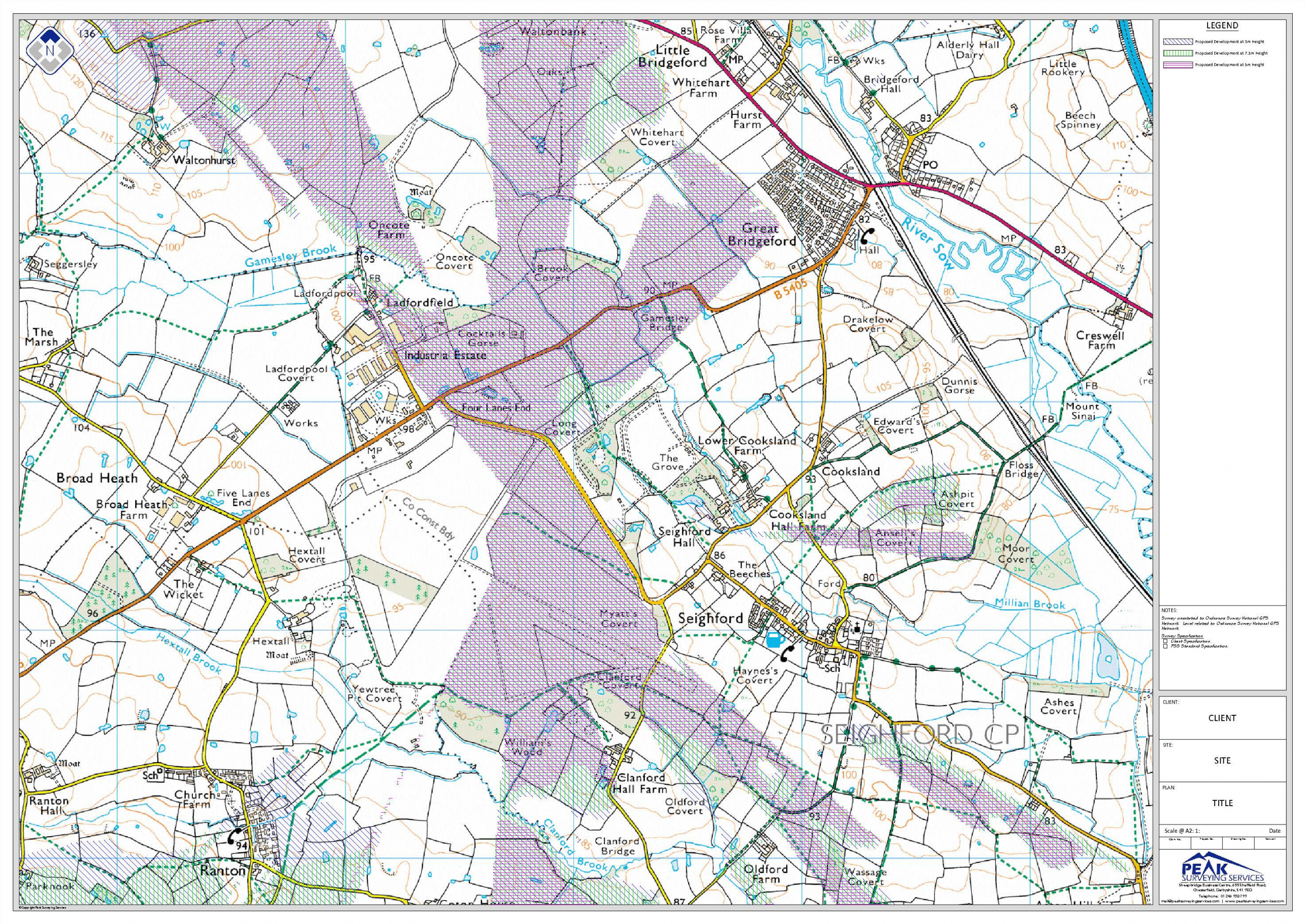
Planning related services available include the use of satellite aerial photographs and 3-dimensional digital data to provide accurate visualisations of proposed developments enabling potential impacts to be assessed and appropriate mitigating screening works to be designed in.
Zones of visual influence (ZVIs) and line of sight sections are readily produced enabling appropriate screening works, operational limits, impacts and mitigation designs to be accurately defined.
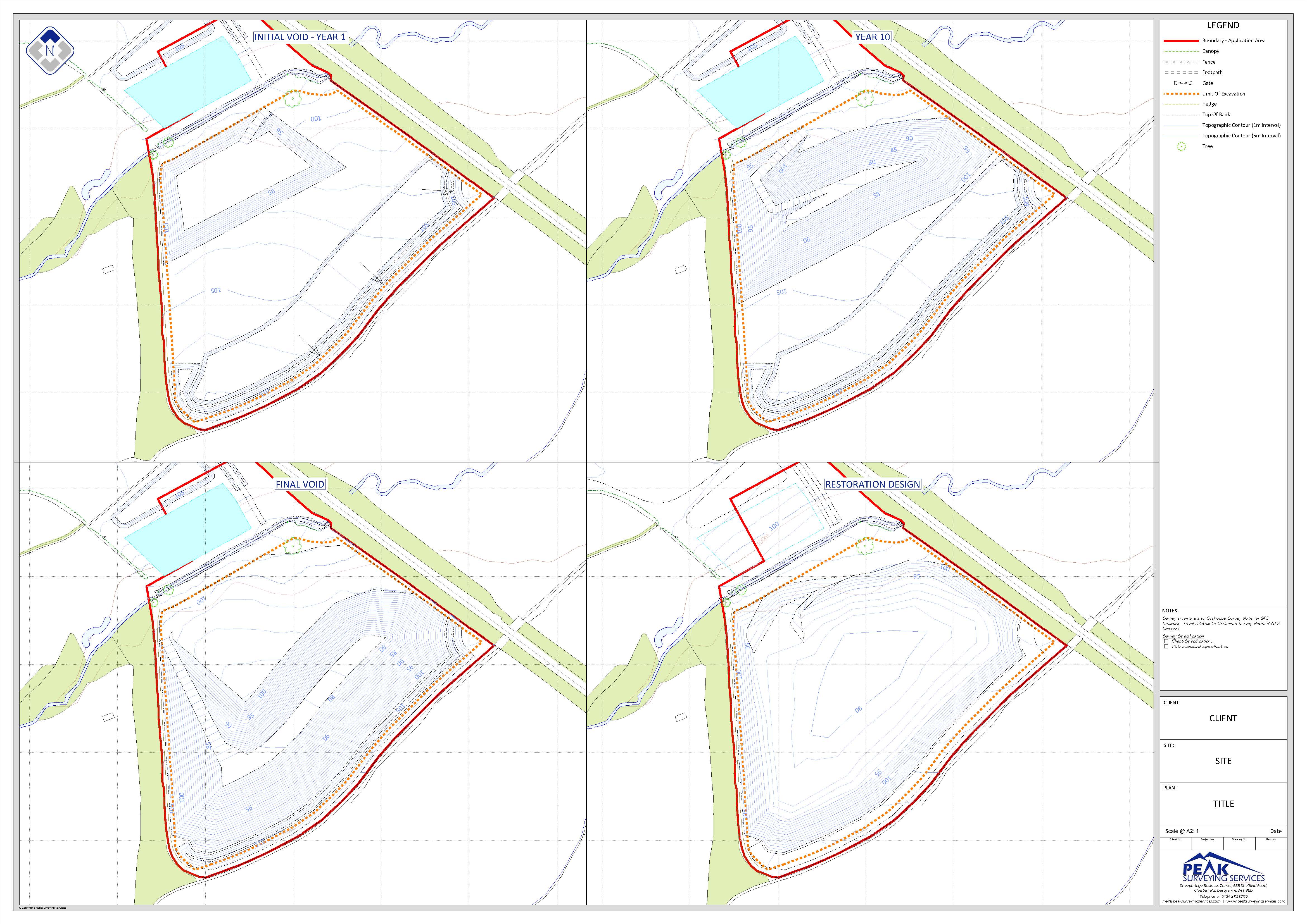
For surface operations using LSS software and our in-house geological, geotechnical and operational planning expertise PSS can provide accurate phasing models for minerals extraction proposals from initial void formation to final restoration.
With reflectorless laser scanning techniques PSS can provide accurate excavation face detail for geological and geotechnical slope stability assessment and modeling purposes.
For underground operations PSS has the capabilities to produce 3D underground mine layout plans – actual and proposed, with superimposed geology.
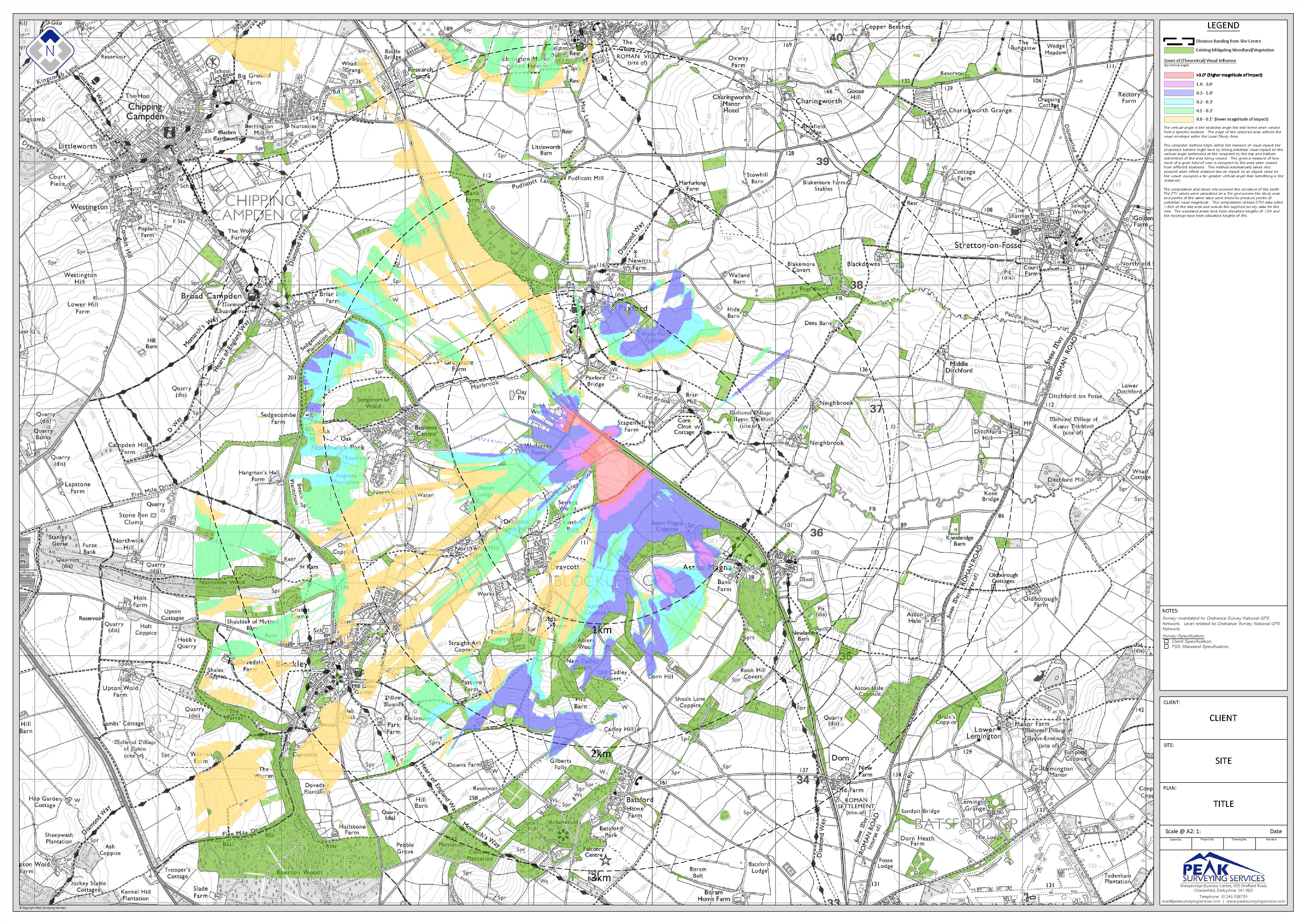
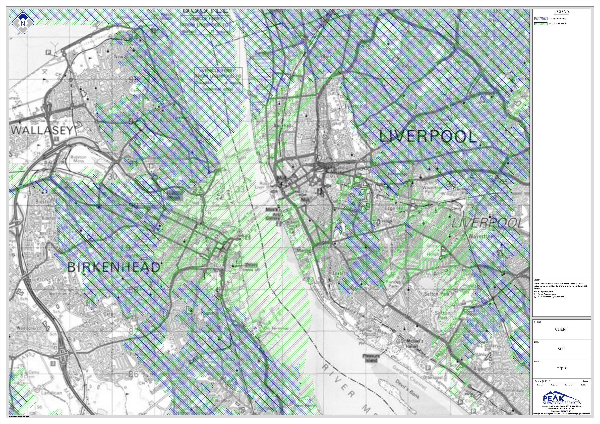
Visual Impact
The superimposition of any form of above ground development will have an effect upon the character of the existing landscape and result in a visual impact for someone somewhere. This change can be accurately defined by performing a Visual Impact Assessment.
Using sophisticated computing software we are able to interrogate models and produce degree of impact [DOI] reports comprising line of site sections and tonal maps generated on either aerial photograph or Ordnance Survey backdrops.
The technique has found great application in the impact assessment of proposed construction developments in a wide variety of environments from rural to urban.